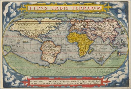
Equator
Imaginary line dividing Earth into Northern and Southern Hemispheres.
The equator is the line of latitude that splits Earth into the Northern and Southern Hemispheres. It is an imaginary circle at 0 degrees latitude, running roughly 40,075 kilometers (24,902 miles) around the planet, and sits halfway between the North and South Poles. The word can also describe a similar line on any other roughly spherical celestial body.
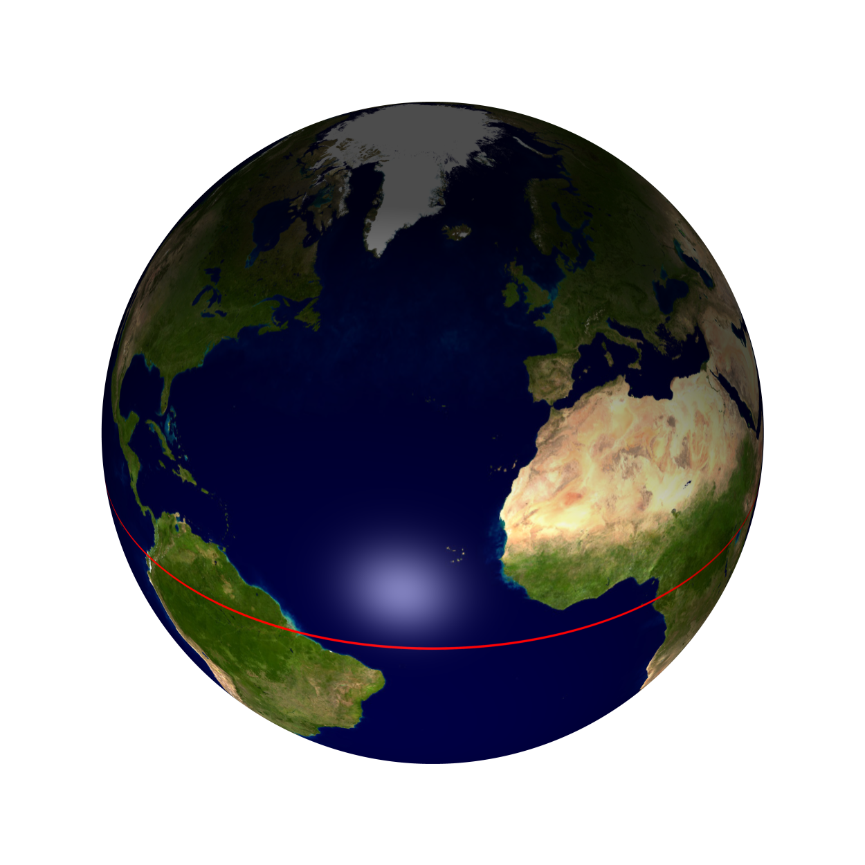
In spatial geometry, especially in astronomy, the equator of a rotating spheroid—like a planet—is the parallel where latitude is set to 0°. It is an imaginary line on the spheroid, equally distant from its poles, cutting it into northern and southern halves. More precisely, it is where the spheroid meets a plane that is perpendicular to its rotation axis and lies midway between its geographic poles.
On Earth, near the equator, the noontime Sun appears almost directly overhead—never more than about 23° from the zenith—every day of the year. This gives the equator a fairly steady daytime temperature year-round. During the equinoxes (around March 20 and September 23), the subsolar point crosses the equator at a shallow angle, sunlight hits perpendicular to Earth’s rotation axis, and every latitude gets nearly 12 hours of daylight and 12 hours of night.
The name comes from the medieval Latin *aequator*, from the phrase *circulus aequator diei et noctis*, meaning “circle equalizing day and night,” rooted in the Latin *aequare*, “to make equal.”
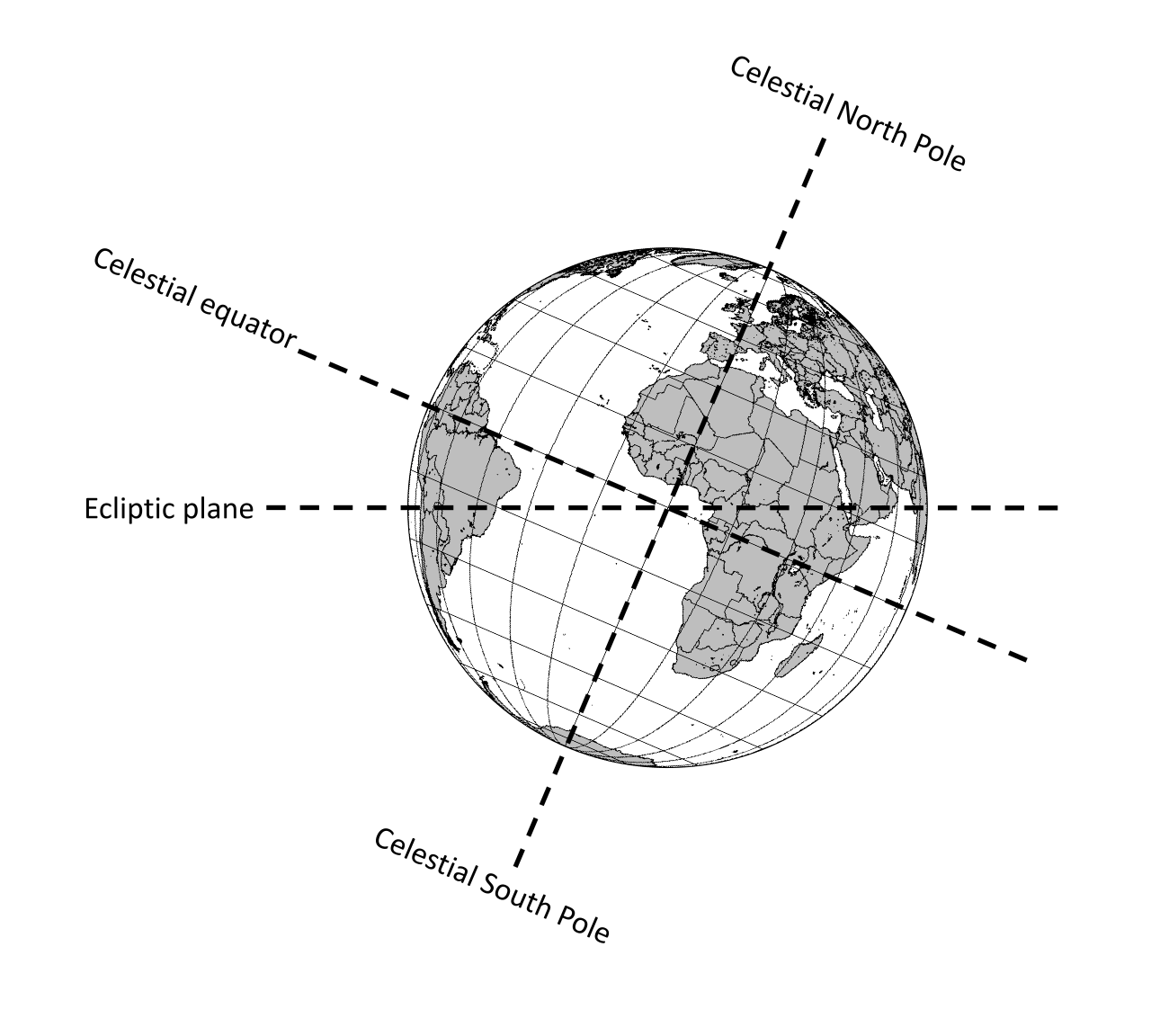
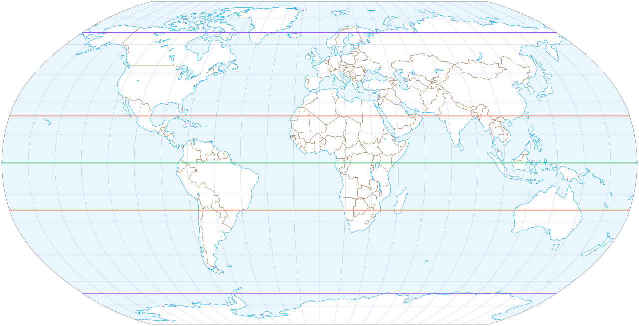
By definition, the equator’s latitude is 0° of arc. It is one of Earth’s five notable circles of latitude, alongside the Arctic and Antarctic Circles and the Tropics of Cancer and Capricorn. The equator is the only line of latitude that is also a great circle—its plane passes through the globe’s center. When that plane is projected onto the celestial sphere, it defines the celestial equator. In the cycle of Earth’s seasons, the equatorial plane aligns with the Sun twice a year, during the March and September equinoxes. To someone on Earth, the Sun then appears to travel along the equator (or celestial equator).
Locations on the equator have the shortest sunrises and sunsets because the Sun’s daily path is nearly perpendicular to the horizon for most of the year. Daylight length stays almost constant, though it is about 14 minutes longer than nighttime due to atmospheric refraction and the fact that sunrise begins (and sunset ends) when the Sun’s upper limb, not its center, touches the horizon.
Earth bulges slightly at the equator. Its average diameter is 12,742 km (7,918 mi), but the equatorial diameter is about 43 km (27 mi) larger than the polar diameter. Sites near the equator, like the Guiana Space Centre in Kourou, French Guiana, make good spaceports because they have the fastest rotational speed of any latitude—460 meters (1,510 feet) per second. This extra speed reduces the fuel needed to launch spacecraft eastward (in the direction of Earth’s rotation) into orbit and avoids costly maneuvers to flatten inclination for missions like geostationary orbit insertion.
The equator’s precise location is not fixed. The true equatorial plane is perpendicular to Earth’s rotation axis, which drifts about 9 meters (30 feet) over a year. Geological samples show that the equator shifted significantly between 48 and 12 million years ago, as sediment deposited by ocean thermal currents at the equator moved. These deposits depend on Earth’s axis, which determines solar coverage of the surface. Changes in the axis can also be seen in the layout of volcanic island chains, created by shifting hot spots under the crust as the axis and crust move. This matches the Indian tectonic plate colliding with the Eurasian plate, which is uplifting the Himalayas.
For exact length, the International Association of Geodesy (IAG) and the International Astronomical Union (IAU) use an equatorial radius of 6,378.1366 km (3,963.1903 mi), codified as the IAU 2009 value. This radius also appears in the 2003 and 2010 IERS Conventions and the IERS 2003 ellipsoid. If the equator were perfectly circular, its length would be exactly 2π times that radius—40,075.0142 km (24,901.4594 mi). The GRS 80 (Geodetic Reference System 1980), approved by the IUGG in 1979, has an equatorial radius of 6,378.137 km (3,963.191 mi). The WGS 84 (World Geodetic System 1984), used in cartography, geodesy, and GPS, also uses 6,378.137 km. For both GRS 80 and WGS 84, the equator’s length is 40,075.0167 km (24,901.4609 mi).
The geographical mile is defined as one arc-minute of the equator, so its value depends on the assumed radius. Under WGS 84, the distance is 1,855.3248 meters (6,087.024 ft); under IAU-2000, it is 1,855.3257 meters (6,087.027 ft). The difference is less than one millimeter over about 1.86 km (1.16 mi). Earth is commonly modeled as a sphere flattened by 0.336% along its axis, making the equator 0.16% longer than a meridian (a great circle through both poles). The IUGG standard meridian is 40,007.862917 km (24,859.733480 mi) to the nearest millimeter; one arc-minute of that is 1,852.216 meters (6,076.82 ft), which explains the SI standardization of the nautical mile.
Lore & Background
The equator is one of the five notable circles of latitude on Earth, the others being the Arctic Circle, Antarctic Circle, Tropic of Cancer, and Tropic of Capricorn. It is the only line of latitude that is also a great circle, meaning its plane passes through the center of the globe. The plane of Earth's equator, when projected outward, defines the celestial equator. On and near the equator, noontime sunlight appears almost directly overhead every day, year-round, resulting in stable daytime temperatures. On the equinoxes (approximately 20 March and 23 September), the subsolar point crosses the equator, and all latitudes have nearly a 12-hour day and 12-hour night. The precise location of the equator is not truly fixed; the true equatorial plane is perpendicular to Earth's rotation axis, which drifts about 9 metres (30 ft) during a year. The equator passes through the land of eleven sovereign states, with Indonesia straddling the greatest length of the equatorial line across both land and sea. Despite its name, no part of Equatorial Guinea lies on the equator.
Reader's Guide
The equator is fundamental to geography, astronomy, and navigation. As the baseline for latitude measurement (0°), it serves as the reference for all other parallels. Its definition as the intersection of a spheroid with a plane perpendicular to its axis of rotation applies to any rotating celestial body, making it a universal concept in astronomy. The geographical mile is defined as one arc-minute of the equator, though its exact value depends on the radius assumed. The equator's role in defining seasons and climate is also significant: near the equator, maximum solar radiation occurs during the equinoxes, and minimum during the solstices, producing a different seasonal pattern than at higher latitudes.
Did You Know?
- The equator is the only line of latitude that is also a great circle.
- The equator's precise location drifts about 9 metres (30 ft) during a year due to changes in Earth's rotation axis.
- The equator passes through the land of eleven sovereign states, with Indonesia straddling the greatest length.
- Despite its name, no part of Equatorial Guinea lies on the equator.
The Equator as the Foundation of Position
The equator occupies a uniquely central role in how humanity maps its planet. Defined as the zero-degree parallel of latitude, it serves as the fundamental reference plane from which all north-south positions are measured. Every point on Earth's surface can be described by the angle between the equatorial plane and a line connecting that point to a corresponding location on the equatorial plane. How that corresponding point is identified depends on the coordinate framework in use: in an astronomical system it follows the local plumb line, in a geodetic system it follows the normal to a reference ellipsoid, and in a geocentric system it simply points to Earth's center. The equator also splits the planet into the Northern and Southern Hemispheres, with the poles sitting at ninety degrees of latitude in each direction. All parallels of latitude trace circles that run parallel to the equator and to one another, creating a nested set of rings that, together with converging meridians, form the familiar grid known as a graticule. This grid is not Cartesian; its measurements are angular rather than linear, and the surface it describes is curved rather than flat.
From Alexandria to the Modern Grid
The intellectual lineage of the equator as a measuring reference stretches back to the third century BC, when Eratosthenes of Cyrene composed his Geography at the Library of Alexandria. His work is now lost, but it is generally regarded as the first systematic attempt to chart positions using angular coordinates. A century later, Hipparchus of Nicaea refined the approach by deriving latitude from stellar observations rather than solar altitude, and by timing lunar eclipses to fix longitude instead of relying on dead reckoning. In the first or second century, Marinus of Tyre produced an extensive gazetteer and a mathematically plotted world map, anchoring his longitude to a prime meridian at the Fortunate Isles near the Canary or Cape Verde Islands. Ptolemy, writing in the second century, retained that prime meridian but shifted the latitude reference to the equator itself. After Arabic translations in the ninth century, Al-Khwārizmī corrected errors in the Mediterranean's length, nudging the medieval Arabic prime meridian roughly ten degrees east of Ptolemy's line. In Europe, Maximus Planudes recovered Ptolemy's text just before 1300, and Jacopo d'Angelo rendered it into Latin in Florence around 1407, reigniting mathematical cartography on the continent.
Datums and the Shifting Equator
A full geographic coordinate system specification, as catalogued in standards such as EPSG and ISO 19111, always pairs the angular definitions of latitude and longitude with a chosen geodetic datum. The datum binds a mathematical model of Earth's shape—typically a reference ellipsoid for horizontal coordinates and a more precise geoid for vertical ones—to the physical planet. Traditionally this binding was achieved through a network of surveyed control points, each marked by a physical monument, and the resulting datum was only accurate over a limited region. Modern datums instead rely on global satellite-based measurement networks, including GNSS, VLBI, SLR, and DORIS, to anchor the model worldwide. The practical consequence is that two users working with different datums will obtain different latitude and longitude values for the very same physical location, sometimes by several hundred meters, not because the ground has moved but because the reference frame itself is shifted. In other words, the equator and every parallel are defined relative to a particular ellipsoid, and changing that ellipsoid subtly repositions the entire grid.
The Zero Point and Global Agreement
The intersection of the equator and the prime meridian marks the origin of the entire graticule, a point that falls in the Gulf of Guinea roughly 625 kilometres south of Tema, Ghana. Cartographers have facetiously dubbed this spot "Null Island." The prime meridian itself was settled by international consensus: at the 1884 International Meridian Conference hosted by the United States, representatives from twenty-five nations gathered, and twenty-two voted to adopt the longitude of the Royal Observatory in Greenwich, southeast London, as the zero reference. The Dominican Republic cast the sole negative vote, while France and Brazil abstained. France eventually adopted Greenwich Mean Time in 1911, replacing the local determinations previously made by the Paris Observatory. The antipodal meridian at 180 degrees is sometimes confused with the International Date Line, but the two are distinct: the Date Line diverges from the 180-degree meridian in several places for political and practical convenience, notably between far eastern Russia and the western Aleutian Islands. Together, the equator and the Greenwich meridian anchor the simplest, oldest, and most universally applied spatial reference system on Earth, one that underpins nearly every other coordinate framework in use today.
Gallery
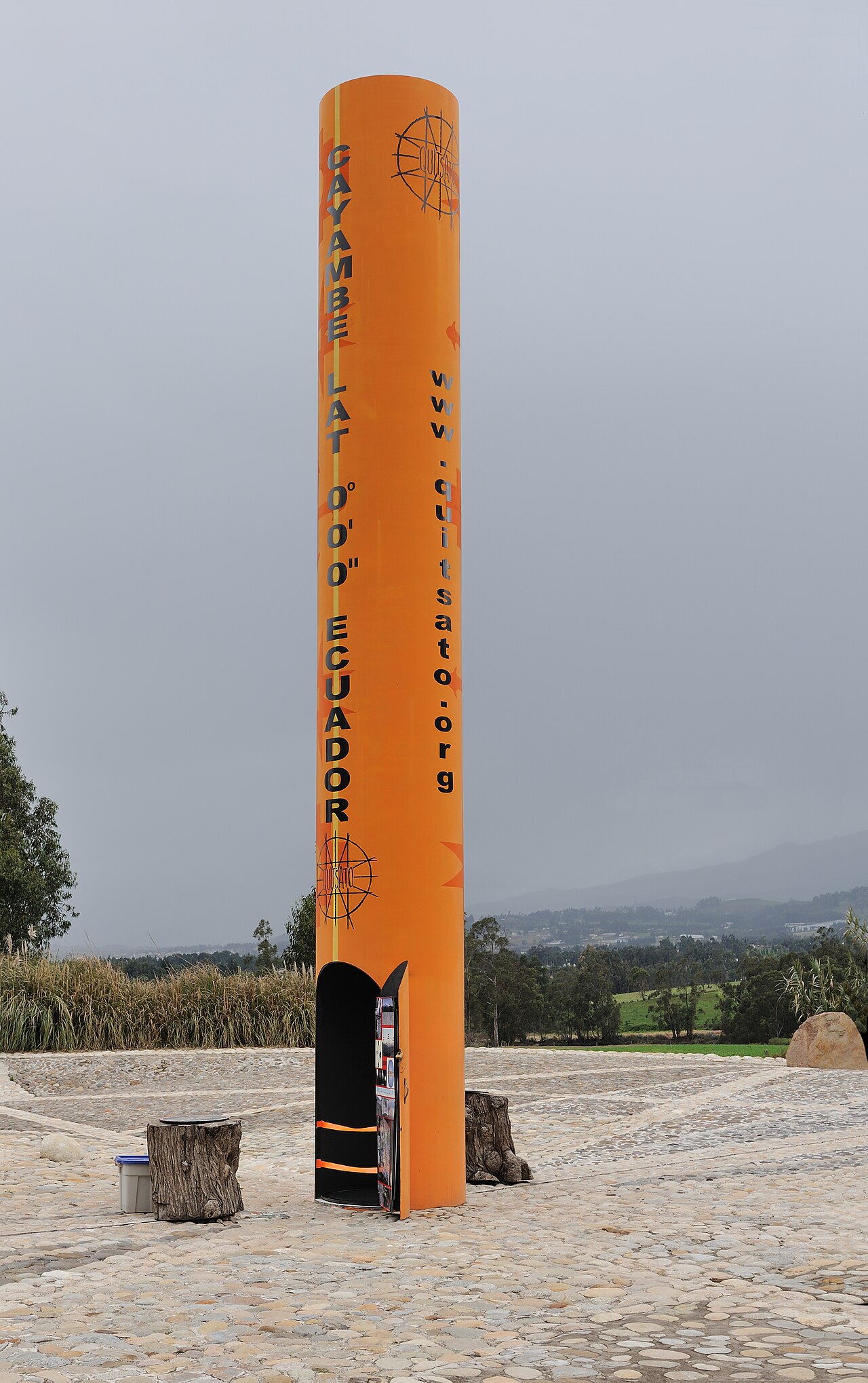
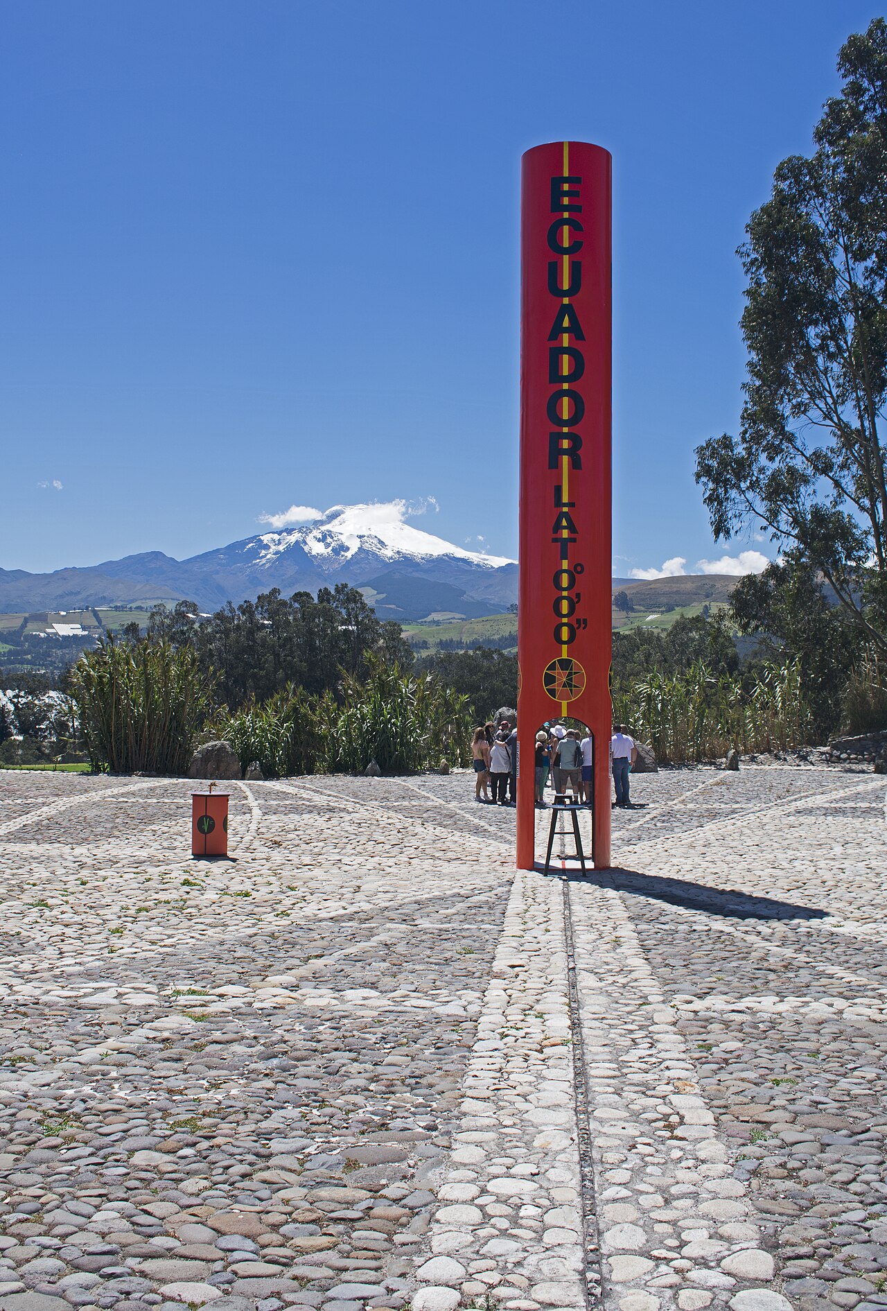
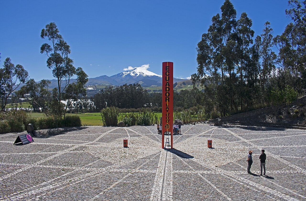
Frequently Asked Questions
What is the Equator in physical geography?
The Equator is an imaginary circle of latitude drawn at 0 degrees that splits Earth into its Northern and Southern Hemispheres. It functions as the baseline reference from which every other latitude measurement is derived.
Where exactly is the Equator positioned?
It sits precisely halfway between the North Pole and the South Pole, encircling the globe at 0 degrees latitude. Every point on that line is equidistant from both poles.
Does the term 'Equator' apply only to Earth?
No—the label can be extended to any roughly spherical celestial body to mark its own zero-latitude dividing circle. In that broader sense, every planet or moon with a defined spin axis has its own equatorial line.
More in Physical Geography & Elevation 1-24
Spotted an error? Know more?
This is a living reference — every entry is fact-audited, and reader corrections feed straight into our audit queue. Suggest an edit · See this site's audit record