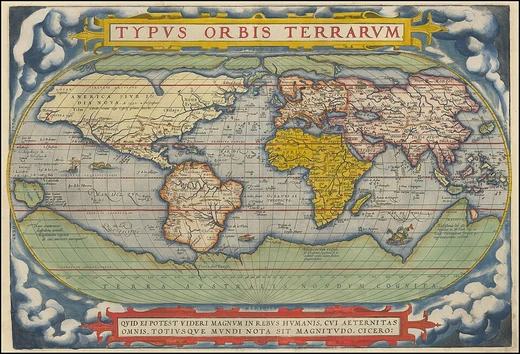
Topography
Study of land surface forms and features.

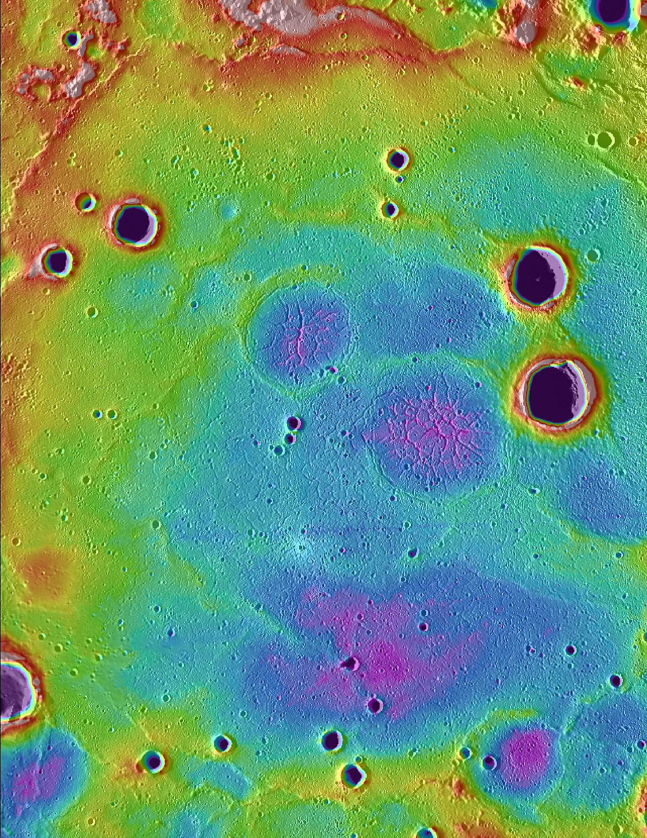
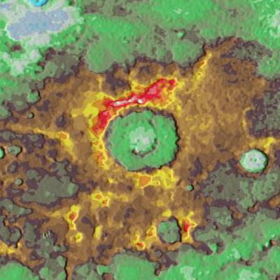
NASA/Johns Hopkins University Applied Physics Laboratory/Carnegie Institution of · Public domain
Topography is the study of forms and features of land surfaces, encompassing both natural and artificial elements such as roads, buildings, and boundaries. It is a field of geoscience and planetary science concerned with local detail, including relief, and is represented through maps using techniques like contour lines, hypsometric tints, and relief shading.
- field
- Geoscience and planetary science
- known_for
- Detailed description and mapping of land surfaces, including relief and cultural features
- etymology
- Greek τόπος (topos, 'place') and -γραφία (-graphia, 'writing')
- key_techniques
- Field survey, remote sensing, lidar, photogrammetry, satellite RADAR mapping
Lore & Background
The term topography originated in ancient Greece and continued in ancient Rome, referring to the detailed description of a place. In classical literature, this meant writing about a place, now largely called local history. In Britain and Europe, the word is still sometimes used in its original sense. Detailed military surveys in Britain, beginning in the late eighteenth century, were called Ordnance Surveys, a term used into the 20th century for topographic surveys and maps. The earliest scientific surveys in France were the Cassini maps, produced by the Cassini family over four generations. The term 'topographic surveys' appears to be American in origin. After the United States Geological Survey assumed national mapping in 1878, the term topographical remained as a general term for detailed surveys and mapping programs, adopted by most other nations as standard. In the 20th century, topography began to be used for surface description in other fields, such as neurology.
Reader's Guide
Topography's significance lies in its foundational role for understanding and representing the Earth's surface. An objective of topography is to determine the position of any feature or point in terms of horizontal coordinates and altitude, as well as identifying features and recognizing landform patterns. Topographic studies have been motivated by military planning and geological exploration, and detailed terrain information is essential for planning and constructing civil engineering, public works, or reclamation projects. Techniques have evolved from direct field surveys using instruments like theodolites and clinometers to modern methods such as lidar, which uses laser scanners to capture high-resolution spatial data with vertical accuracy of 10 centimeters, and photogrammetry, which determines 3D coordinates from photographic images. Satellite RADAR mapping is a major technique for generating Digital Elevation Models. Topographic data is modeled using vector (triangulated irregular network) or gridded (raster) mathematical models. The legacy of topography includes the creation of digital elevation datasets like USGS DEM data, which form the basis for large-scale analysis, and its adoption in other fields such as neurology for surface description.
Did You Know?
- The term topography comes from the Greek τόπος (topos, 'place') and -γραφία (-graphia, 'writing').
- In the United States, topography often means specifically relief, even though USGS topographic maps record roads, populated places, and land boundaries.
- Lidar surveys can achieve a vertical accuracy of 10 centimeters.
Elevation, Altitude, and the Reference Problem
The fundamental concept of elevation is its height relative to a fixed reference point, most commonly a reference geoid—a mathematical model representing Earth's sea level as an equipotential gravitational surface. This distinction matters because the term elevation is reserved for points on Earth's surface, while altitude or geopotential height applies to objects above the surface such as aircraft or spacecraft, and depth covers points below it. Crucially, elevation should not be confused with distance from Earth's center. Because the planet bulges at the equator, the summit of Mount Everest holds the title for greatest elevation, yet Chimborazo actually sits farther from the planet's core. This subtle geometric reality means that the tallest mountain by one measure is not the same as the farthest point from Earth's center, a distinction that underscores how our choice of reference frame shapes what we call high.
Elevation in Aviation Operations
In the world of aviation, elevation takes on a very specific operational meaning. The International Civil Aviation Organization defines aerodrome elevation as the highest point of a landing area, a figure typically recorded in feet and readily available in approach charts for each aerodrome. This precise measurement is critical for pilots planning approaches and landings, as it provides a fixed ground reference against which all vertical navigation is calculated. It is important not to conflate this with altitude or height, which refer to measurements above a reference surface rather than the surface itself. The ICAO's standardized definition ensures that pilots across different countries and airspaces work from a consistent understanding of where the ground actually is, reducing the risk of misinterpretation during critical flight phases.
Digital Terrain and the USGS 3DEP Program
Modern geography has moved far beyond hand-drawn contour lines on paper. While topographical maps remain the primary tool for depicting elevation—traditionally through contour lines—Geographic Information Systems now offer sophisticated digital representations. A GIS is a computer system enabling the visualization, manipulation, capture, and storage of spatial data with associated attributes, allowing analysts to understand landscape patterns at multiple scales. Within these systems, digital elevation models represent a place's surface as a raster grid of elevation values, while digital terrain models provide another avenue for terrain representation. The United States Geological Survey is developing the 3D Elevation Program to meet growing demand for high-quality topographic data. 3DEP compiles enhanced elevation data in the form of high-quality LiDAR coverage across the contiguous United States, Hawaii, and U.S. territories, offering three bare-earth DEM layers that are nationally seamless at resolutions of one-third, one, and two arcseconds.
Vertical Datums and Global Standards
Because elevation is always measured relative to a reference, the choice of that reference—called a vertical datum—carries enormous practical weight. Different nations and agencies have established their own standards. The Netherlands uses the Amsterdam Ordnance Datum, known as Normaal Amsterdams Peil, while Germany relies on Normalhöhennull, literally standard elevation zero. In the United States, the Sea Level Datum of 1929 has been superseded by the North American Vertical Datum of 1988, and the National Geodetic Survey even provides an online converter between the two. These datums are not arbitrary; they are grounded in the geoid, a mathematical model of Earth's sea level as an equipotential gravitational surface. The existence of multiple, sometimes competing, reference systems highlights that what we call height is always a negotiated, standardized convention rather than an absolute truth.
Gallery
Frequently Asked Questions
What is Topography in the context of physical geography and elevation?
Topography is the branch of geoscience and planetary science dedicated to describing and mapping the shapes, forms, and features of land surfaces. It covers both natural elements like mountains and valleys and artificial ones like roads and buildings, with particular emphasis on local relief.
What key techniques does Topography rely on?
Topographers use methods such as field surveys, remote sensing, lidar, photogrammetry, and satellite RADAR mapping to capture detailed terrain information. These tools let them record elevation, slope, and surface features at a local scale.
Where does the word Topography come from?
The term is built from two Greek roots: 'topos,' meaning place, and '-graphia,' meaning writing. Together they essentially describe the act of recording or writing down the details of a particular place.
How does Topography represent three-dimensional land on a flat map?
Standard cartographic tools include contour lines, hypsometric tints, and relief shading, all of which translate elevation and slope into two-dimensional visuals. These techniques let a reader quickly interpret landscape structure and vertical change.
Why is Topography considered important within the Physical Geography & Elevation series?
Topography operates at the local-detail level of geoscience, connecting broad geological processes to the specific relief and cultural features people encounter on the ground. It provides the foundational framework for understanding how elevation shapes drainage, settlement, and land use.
More in Physical Geography & Elevation 1-24
Elsewhere in the Physical Geography & Elevation universe
Spotted an error? Know more?
This is a living reference — every entry is fact-audited, and reader corrections feed straight into our audit queue. Suggest an edit · See this site's audit record