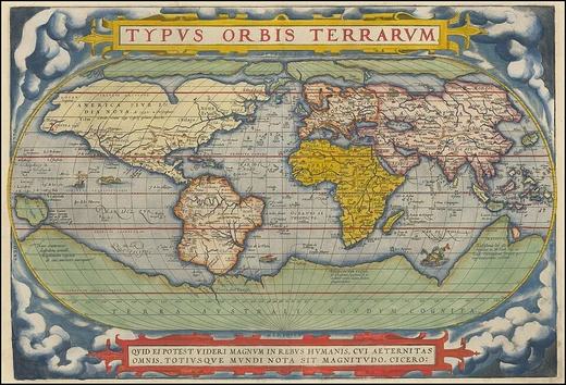
Circle of latitude
Imaginary lines parallel to the Equator defining latitude.

SharkD · Public domain
A circle of latitude, also called a parallel, is an abstract east–west small circle on Earth connecting all locations at a given latitude coordinate line, ignoring elevation. These circles are parallel to each other, never intersecting, and their length decreases as distance from the Equator increases, calculated by a cosine function. Circles of latitude are fundamental for mapping, navigation, and defining geographical zones, with the Equator being the only one that is also a great circle.
- type
- Geographical concept
- key_feature
- Parallel east–west circles at constant latitude
- longest_circle
- Equator (0° latitude)
- major_circles
- Arctic Circle, Tropic of Cancer, Equator, Tropic of Capricorn, Antarctic Circle
- number_of_integral_circles
- 89 between Equator and each pole per hemisphere
- used_for
- Borders, navigation, map projections, defining climate zones
Lore & Background
Circles of latitude are often called parallels because they are parallel to each other; planes containing any of these circles never intersect. Their length can be calculated by a common sine or cosine function; for example, the 60th parallel north or south is half as long as the Equator, stemming from cos(60°) = 0.5. On cylindrical projections like the Mercator or Gall-Peters, a circle of latitude is perpendicular to all meridians. On a spherical Earth, only the Equator and meridians are rhumb lines (lines of constant bearing); other circles of latitude are not rhumb lines. The latitude of a circle is approximately the angle between the Equator and the circle, with the vertex at Earth's centre. The Equator is at 0°, the North Pole at 90° north, and the South Pole at 90° south. There are 89 integral circles of latitude between the Equator and each pole, but these can be divided into more precise measurements. On maps, circles of latitude may or may not be parallel depending on the projection; on an equirectangular projection they are horizontal, parallel, and equally spaced, while on a Mercator projection they are more widely spaced near the poles. Arcs of circles of latitude are sometimes used as boundaries between countries or regions where distinctive natural borders are lacking. For instance, the northern border of Colorado is at 41° N and the southern border at 37° N, and roughly half the length of the border between the United States and Canada follows 49° N. The five major circles of latitude—Arctic Circle, Tropic of Cancer, Equator, Tropic of Capricorn, and Antarctic Circle—mark divisions between the five principal geographical zones.
Reader's Guide
Circles of latitude are essential for geographic reference, navigation, and cartography. They provide a systematic way to locate positions on Earth, with latitude measured as an angle from the Equator. The Equator, the longest circle of latitude, divides Earth into Northern and Southern Hemispheres and is the only circle of latitude that is also a great circle. The major circles—the Arctic and Antarctic Circles and the Tropics of Cancer and Capricorn—define the boundaries of polar, temperate, and tropical zones, and their positions shift slowly due to changes in Earth's axial tilt. These parallels are widely used in map projections, each projection handling them differently to preserve certain properties like shape, area, or distance. They also serve as practical borders for nations and states, especially where natural features are absent. The concept extends to other planets with axial tilts, where similar circles can be defined. Understanding circles of latitude is fundamental to geography, astronomy, and global positioning systems.
Did You Know?
- The 60th parallel north or south is half as long as the Equator, because cos(60°) = 0.5.
- The Equator is the only circle of latitude that is also a great circle.
- The positions of the Tropical and Polar Circles are not fixed; they drift due to changes in Earth's axial tilt, currently by about 22 m per year.
- On the Mercator projection, circles of latitude are more widely spaced near the poles to preserve local scales and shapes.
Ancient Origins and the Birth of Measured Space
The credit for inventing a geographic coordinate system is generally given to Eratosthenes of Cyrene, who composed his now-lost Geography at the Library of Alexandria during the 3rd century BC. A century later, Hipparchus of Nicaea refined the approach by deriving latitude from stellar observations rather than solar altitude and calculating longitude through the timing of lunar eclipses instead of dead reckoning. In the 1st or 2nd century, Marinus of Tyre produced an extensive gazetteer and a mathematically plotted world map, measuring longitude eastward from a prime meridian placed at the Fortunate Isles—likely near the Canary or Cape Verde Islands off western Africa—and measuring latitude relative to the island of Rhodes. Ptolemy's 2nd-century Geography retained that same prime meridian but shifted the latitude reference to the Equator. After Arabic translations in the 9th century, Al-Khwārizmī corrected errors in the Mediterranean's length, nudging medieval Arabic cartography toward a prime meridian roughly 10° east of Ptolemy's line.
Three Ways to Define a Point's Angle
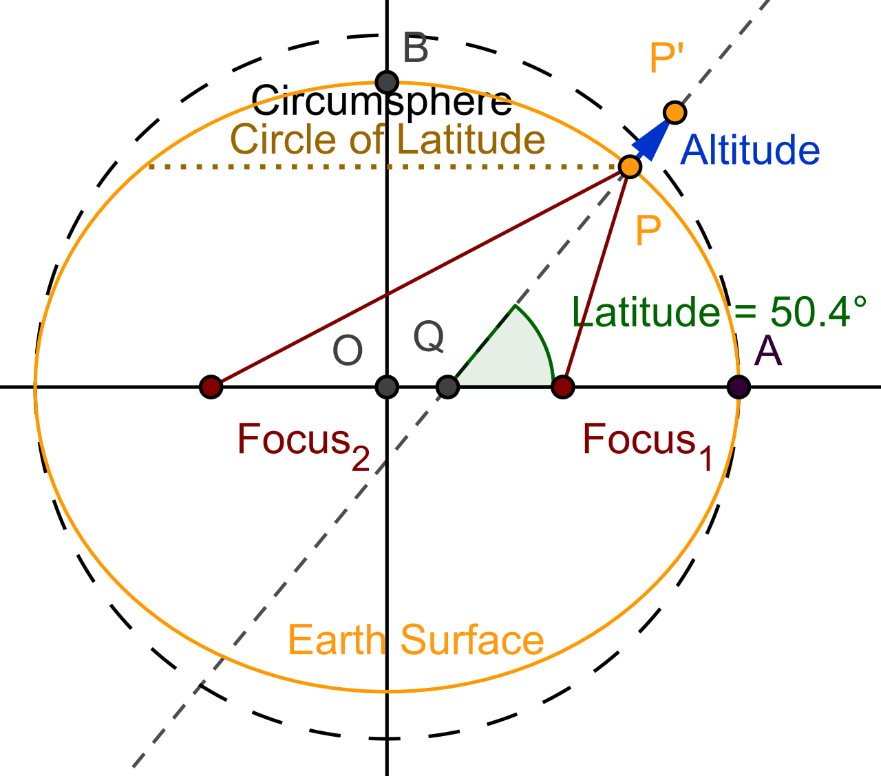
Latitude can be defined in three distinct ways depending on the coordinate system in use. In an astronomical system, the reference point on the equatorial plane is found by extending the plumb bob vertical from the surface point until it intersects that plane. In a geodetic system, the reference is determined by the normal vector from the surface of the reference ellipsoid at that point, extended to meet the equatorial plane. In a geocentric system, the reference point is simply the center of the Earth itself. Each method produces a slightly different angle for the same physical location because the Earth is neither a perfect sphere nor perfectly uniform in its gravitational pull. The path connecting all points sharing the same latitude forms a circle when viewed from above either pole—these are called parallels, and they run parallel to the equator and to one another. The equator itself sits at 0°, the North Pole at 90° N, and the South Pole at 90° S, dividing the globe into Northern and Southern Hemispheres.
The Datum Problem and Modern Reference Networks
Theoretical definitions of latitude, longitude, and height only become practically useful when anchored to a geodetic datum. A horizontal datum binds a reference ellipsoid to the physical Earth for measuring latitude and longitude, while a vertical datum links a more precise geoid model for measuring elevation. Traditionally, this binding relied on networks of surveyed control points with installed monuments, accurate only over a limited regional area. Modern datums instead draw on global satellite measurement networks using technologies such as GNSS, VLBI, SLR, and DORIS. This combination of a mathematical model and a physical binding guarantees that users of the same datum will obtain identical coordinates for any given point. However, switching to a different datum typically shifts the coordinates for that same location—sometimes by several hundred meters—not because the point has moved, but because the entire reference frame has been repositioned. Standards bodies like EPSG and ISO 19111 catalog these full specifications, including the chosen ellipsoid, so that coordinate values remain unambiguous across disciplines.
The Graticule, the Prime Meridian, and Null Island
When lines of latitude and longitude are drawn together on a map, they form a visual grid called a graticule. The origin of this system—the point where 0° latitude meets 0° longitude—falls in the Gulf of Guinea, roughly 625 km south of Tema, Ghana, a spot often humorously dubbed Null Island. The international prime meridian runs through the Royal Observatory in Greenwich, southeast London, a decision formalized at the 1884 International Meridian Conference in the United States, where twenty-two of twenty-five attending nations agreed to adopt Greenwich as the zero-reference line; the Dominican Republic voted against, while France and Brazil abstained. France eventually switched from its Paris Observatory local time to Greenwich Mean Time in 1911. The antipodal meridian, at 180° east and west, should not be confused with the International Date Line, which partly overlaps the 180° meridian but diverges in several places for political and practical convenience, notably between far eastern Russia and the far western Aleutian Islands.
Gallery
Frequently Asked Questions
Who is Circle of latitude?
A circle of latitude, often called a parallel, is an imaginary east–west ring drawn around Earth that links every point sharing the same latitude value. It is purely a coordinate construct, so it ignores terrain elevation and exists only as a geometric reference on the globe.
What are Circle of latitude's powers and role?
Parallels serve as the backbone for navigation, cartographic projections, and the drawing of national borders. They also delineate climate zones and mark the boundaries of the tropical, temperate, and polar regions.
How does Circle of latitude's story end?
As you move from the Equator toward either pole, each successive parallel shrinks in circumference according to a cosine relationship. At 90° north or south the circle collapses into a single point—the pole itself—so there are 89 whole-degree parallels between the Equator and each pole.
Who are the major Circle of latitude characters?
Five named parallels stand out in common usage: the Equator (0°), the Tropic of Cancer (~23.5° N), the Tropic of Capricorn (~23.5° S), the Arctic Circle (~66.5° N), and the Antarctic Circle (~66.5° S). Together they define the boundaries of the tropics and the polar regions.
More in Physical Geography & Elevation 25-30
Elsewhere in the Physical Geography & Elevation universe
Spotted an error? Know more?
This is a living reference — every entry is fact-audited, and reader corrections feed straight into our audit queue. Suggest an edit · See this site's audit record