Tropic of Capricorn
Southernmost latitude where the Sun is directly overhead.

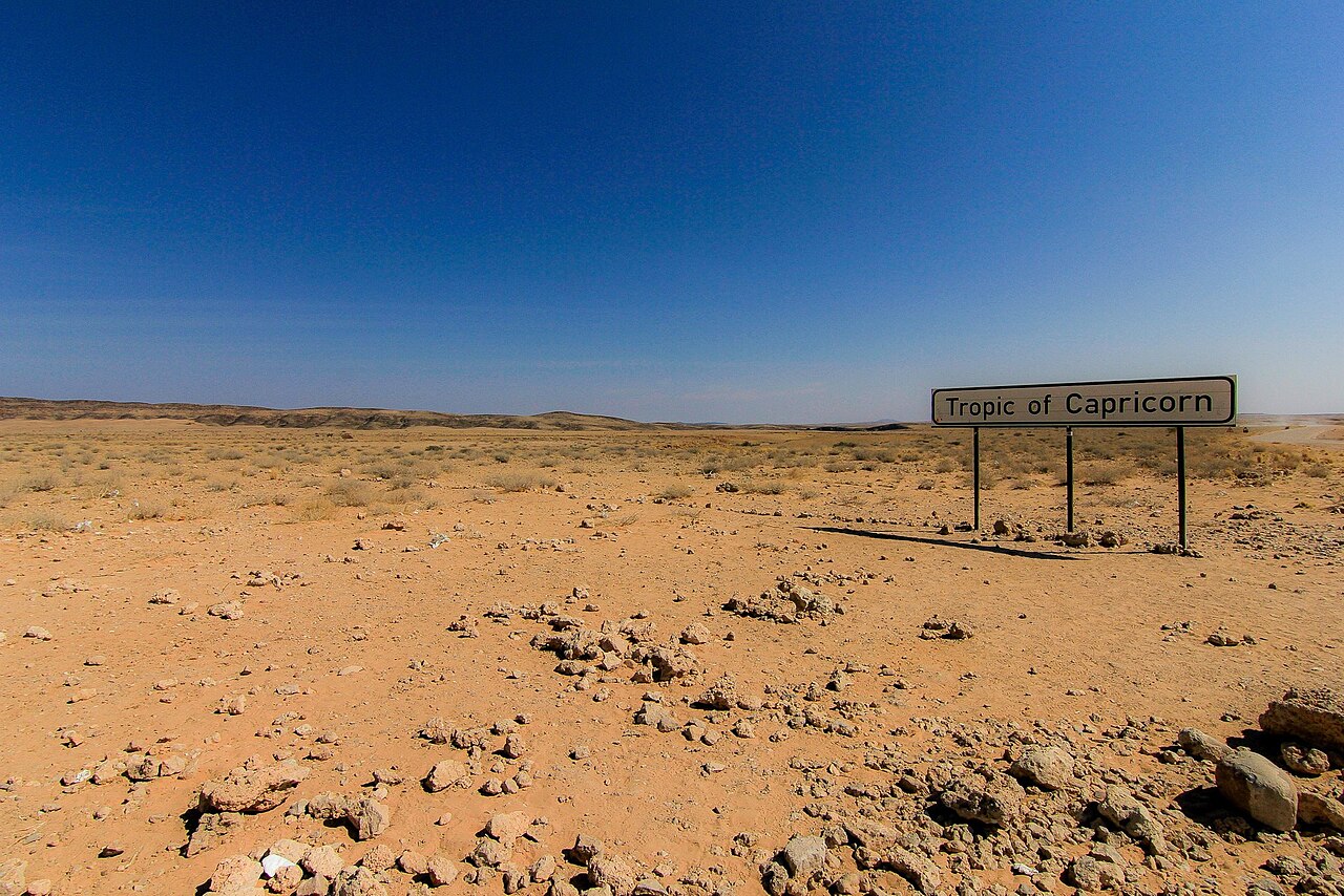
Ben Cordia · CC BY-SA 4.0
The Tropic of Capricorn is the circle of latitude that contains the subsolar point at the December solstice, making it the southernmost latitude where the Sun can be seen directly overhead. It is one of the five major circles of latitude marked on maps of Earth, currently located at 23°26′09.0″ south of the Equator, and is gradually moving northward at a rate of 0.47 arcseconds per year. Its Northern Hemisphere counterpart is the Tropic of Cancer.
- movement
- 0.47 arcseconds (15 metres) northward per year
- daylight_June_solstice
- 10 hours 41 minutes
- daylight_December_solstice
- 13 hours 35 minutes
Lore & Background
When this line of latitude was named, the Sun was in the zodiacal Capricorn at the December solstice (southern summer). Due to the precession of the equinoxes, the Sun currently appears in the zodiacal Sagittarius at that solstice.
Reader's Guide
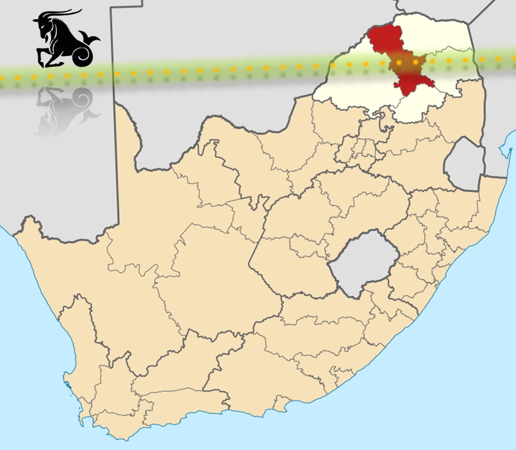
The Tropic of Capricorn serves as the dividing line between the Southern Temperate Zone to the south and the Tropics to the north. In Africa, the belt around this latitude supports seasonal rainfall and farming, with practices such as holistic management promoted by Allan Savory to combat desertification. In Australia, areas around the Tropic experience highly variable rainfall, with the Great Dividing Range providing relief precipitation for cultivation, while the interior features arid landscapes like the Channel Country and Gibson Desert. In South America, the Tropic passes through productive agricultural regions in Brazil and Argentina, while west of the Andes the Atacama Desert, one of the driest in the world, lies under its influence. The Tropic of Capricorn passes through 10 countries, and only four countries—Eswatini, Lesotho, New Zealand, and Uruguay—are wholly south of it.
Did You Know?
- The Tropic of Capricorn is gradually moving northward at a rate of 0.47 arcseconds (15 metres) per year.
- At solar midnight on the June solstice, the Sun is 90 degrees below the horizon in all directions at this latitude.
- The Tropic of Capricorn was named when the Sun was in the zodiacal Capricorn at the December solstice; it now appears in Sagittarius due to precession.
- Four countries are entirely south of the Tropic of Capricorn: Eswatini, Lesotho, Uruguay, and New Zealand. (Eswatini is often mistakenly thought to be entirely south, but it actually straddles the line.)
The Line That Divides Seasons
The Tropic of Capricorn sits at approximately 23.5 degrees south latitude and serves as the southernmost boundary of Earth's tropical belt. Everything poleward of this line, stretching all the way to the Antarctic Circle at roughly 66.5 degrees south, falls within what geographers call the south temperate zone. This zone is defined by wider annual temperature swings and more pronounced seasonal shifts compared to the tropics, where the sun's near-perpendicular angle keeps temperatures relatively constant and the primary seasonal difference tends to be rainfall rather than heat. The Tropic of Capricorn thus acts as a climatic dividing line: on its equatorward side, the sun's angle never drops far enough to produce true cold seasons, while on its poleward side, the sun's lower winter angle introduces frosts, cooler months, and the full cycle of four distinct seasons that characterizes temperate living across the globe.
A Zone Shaped by More Than Latitude
The south temperate zone, bounded by the Tropic of Capricorn to the north and the Antarctic Circle to the south, encompasses a vast stretch of Earth's surface where climate is shaped by the interplay of multiple forces. Unlike the tropics, this zone experiences the sun's angle shifting dramatically between solstices, producing genuine seasonal change in temperature. Within this band, climate is not determined by latitude alone. Prevailing wind patterns, the direction and temperature of ocean currents, the sheer size of adjacent landmasses, and elevation all conspire to produce a wide spectrum of local weather. Some areas near the Tropic of Capricorn enjoy mild, rain-fed winters and warm summers, while regions farther south face harsher cold. The zone can be further subdivided into subtropical and cool temperate sub-zones based on monthly temperature records, the behavior of the coldest month, and how precipitation is distributed across the year.
Subtropical Climates Just Beyond the Tropic
Immediately poleward of the Tropic of Capricorn, between roughly 23.5 and 35 degrees south, lie the subtropical climates of the temperate zone. These regions feel the lingering influence of the tropics more strongly than any other temperate type, producing longer, hotter summers and shorter, milder winters where freezing precipitation is rare. Three major variants dominate. Humid subtropical climates, found along the leeward lower east coasts of continents, deliver long, hot, humid summers punctuated by convective thunderstorms and mild, above-freezing winters, often aided by warm coastal ocean currents. Mediterranean climates, concentrated on western continental margins, flip the rainfall pattern entirely: summers are dry, fed by arid winds sweeping from equatorward deserts, while winters bring cool, wet air from poleward oceanic sources. Subtropical highland climates, tucked into mountainous terrain, maintain mild temperatures year-round, with rainfall either evenly distributed or split into dry winters and wet summers under monsoon influence.
Köppen's Language for the Temperate World
The Köppen climate classification system provides the formal language for distinguishing the climates that begin at the Tropic of Capricorn. A climate is labeled temperate, or class C, when the coldest month's mean temperature stays above minus 3 degrees Celsius but below 18 degrees Celsius, a threshold designed to account for the persistence of frost. Some regional adaptations of the system raise that floor to 0 degrees Celsius. Beyond this core definition, the broader concept of temperate can extend to include continental climates, class D, where the coldest month typically dips below minus 3 degrees and seasonal extremes become far more severe. These D climates, driven by vast landmasses and shifting seasonal wind patterns rather than maritime moderation, produce hot summers and genuinely cold winters. They sit within the same latitudinal band the Tropic of Capricorn helps delineate, reminding us that a single line of latitude cannot capture the full complexity of how heat, moisture, and air movement interact across Earth's middle latitudes.
Gallery


Frequently Asked Questions
What is the Tropic of Capricorn?
It is one of Earth's five principal latitude circles, marking the southernmost line where the Sun can appear directly overhead. On modern maps it sits at approximately 23°26′ south of the Equator.
What makes the Tropic of Capricorn special compared to other latitude lines?
On the December solstice the subsolar point lands exactly on this circle, meaning the Sun is at its zenith for observers standing there. It is the southern boundary of the Sun's yearly overhead path, with the Tropic of Cancer serving as the northern equivalent.
How does daylight at the Tropic of Capricorn compare between the two solstices?
On the June solstice you get roughly 10 hours 41 minutes of daylight, while the December solstice stretches to about 13 hours 35 minutes. The difference reflects the fact that the December solstice is when the Sun is directly overhead at this latitude.
More in Physical Geography & Elevation 25-30
Elsewhere in the Physical Geography & Elevation universe
Spotted an error? Know more?
This is a living reference — every entry is fact-audited, and reader corrections feed straight into our audit queue. Suggest an edit · See this site's audit record