
Terrain
The dimension and shape of a given land surface.

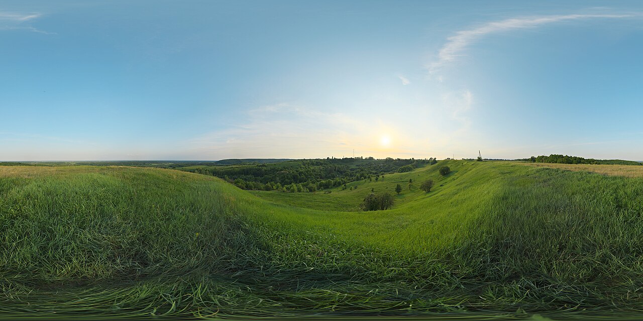
Terrain, from Latin 'terra' meaning earth, also known as relief or topographical relief, refers to the dimension and shape of a given land surface. In physical geography, it is the lay of the land, expressed in terms of elevation, slope, and orientation of terrain features. Terrain affects surface water flow and distribution, and over large areas can influence weather and climate patterns. Bathymetry studies underwater relief, while hypsometry studies terrain relative to sea level.
- field
- Physical geography, geomorphology
- known_for
- Dimension and shape of land surfaces; critical for settlement, agriculture, hydrology, military strategy, aviation, and weather patterns
Lore & Background
Terrain is formed by concurrent processes operating on underlying geological structures over geological time. Geological processes include migration of tectonic plates, faulting and folding, mountain formation, and volcanic eruptions. Erosional processes include glacial, water, wind, chemical, and gravitational actions such as landslides, downhill creep, flows, slumps, and rock falls. Extraterrestrial processes such as meteorite impacts also shape terrain. Tectonic processes like orogenies and uplifts elevate land, while erosional and weathering processes wear it away. The relationship between erosion and tectonics rarely reaches equilibrium, and their full range of interactions remains a topic of debate.
Reader's Guide
Understanding terrain is critical for many reasons. It largely determines suitability for human settlement, as flatter alluvial plains tend to have better farming soils than steeper, rockier uplands. In environmental quality, agriculture, and hydrology, terrain assists understanding of watershed boundaries, drainage characteristics, groundwater systems, and water quality. Complex relief data are used as input for hydrology transport models to predict river water quality. Terrain supports soil conservation through practices like contour ploughing. Militarily, terrain determines the ability to take and hold areas and move troops and material; its military usage encompasses landform, land use, land cover, infrastructure, and even human terrain factors. Terrain is important in determining weather patterns, as areas close geographically may differ in precipitation due to elevation or rain shadow effects. In aviation, precise terrain knowledge is vital for low-flying routes, airport altitudes, and radar performance. Relief refers to quantitative measurement of vertical elevation change, the difference between maximum and minimum elevations within a given area. Relief energy indicates ruggedness or relative height of terrain. Geomorphology studies the long-term formation of terrain, and land surface parameters measure morphometric properties such as slope, aspect, and curvatures, which can derive hydrological and climatic parameters.
Did You Know?
- Bathymetry is the study of underwater relief, while hypsometry studies terrain relative to sea level.
- Contour ploughing is an established practice enabling sustainable agriculture on sloping land by ploughing along lines of equal elevation.
- Relief energy is essentially an indication of the ruggedness or relative height of the terrain.
- Terrain is formed by geological processes, erosional processes, and extraterrestrial processes such as meteorite impacts.
The Tangled Web of DEM, DTM, and DSM Terminology
Despite decades of widespread use in geospatial science, the terms digital elevation model, digital terrain model, and digital surface model remain frustratingly inconsistent across the literature. In the most common interpretation, a digital surface model captures the full earth surface including trees, rooftops, and every other object above the ground, while a digital terrain model strips all of that away to reveal only the bare earth beneath. The digital elevation model is frequently deployed as an umbrella label encompassing both, describing height information without specifying which surface is actually measured. Complicating matters, some authors treat DEM and DTM as interchangeable, others equate DEM with DSM, and still others define a DEM as a rectangular grid while reserving DTM for a three-dimensional triangular network. Major data providers such as the USGS, ERSDAC, CGIAR, and Spot Image simply adopt DEM as a catch-all. Even specific datasets blur the lines: the Shuttle Radar Topography Mission and the ASTER GDEM are technically surface models, yet in heavily forested regions the radar signal penetrates the canopy, producing readings that fall between a true surface model and a bare-earth model. Generating a genuine terrain model from a surface model requires a process called bare-earth extraction, in which complex algorithms filter out buildings and vegetation.
From Satellites to Ground Truth: How Terrain Data Is Built
Modern terrain models are most often constructed from remote-sensing data rather than direct ground surveys, though both approaches remain in active use. The dominant technique is interferometric synthetic aperture radar, in which two passes of a radar satellite such as RADARSAT-1, TerraSAR-X, or Cosmo SkyMed collect overlapping observations, or a single pass with two antennas, as in the SRTM instrument, generates elevation maps tens of kilometers across at roughly ten-meter resolution. Stereoscopic optical pairs offer an alternative: the HRS instrument aboard SPOT 5 has gathered more than one hundred million square kilometers of stereo imagery, while the VNIR band of ASTER on the Terra satellite uses double-pass stereo correlation. The lineage stretches back to SPOT 1 in 1986, which delivered the first broadly usable elevation data for a significant portion of the planet's landmass, followed by the European Remote-Sensing Satellite in 1991 and both SRTM and ASTER around 2000. In rugged mountain terrain where interferometry proves unreliable, mappers still interpolate digital contour maps derived from direct surveying. The resulting data can be stored as a raster heightmap, considered a secondary or computed representation, or as a triangular irregular network, regarded as a primary measured product.
Mapping Worlds Beyond Earth
The same elevation-modeling techniques that chart terrestrial landscapes have become indispensable tools in planetary science, where orbital altimetry provides the primary means of constructing digital elevation maps of other bodies. Laser altimetry is the leading method, with dedicated instruments having mapped the surfaces of Mars through the Mars Orbiter Laser Altimeter, the Moon via both the Lunar Orbital Laser Altimeter and the Lunar Altimeter, and Mercury with the Mercury Laser Altimeter. Radar altimetry serves as a complementary approach for worlds where laser returns are impractical. A distinctive feature of planetary mapping is that each body carries its own unique reference surface, meaning the zero-elevation datum is not universal but tailored to the specific planet or moon being studied. Beyond altimetry, stereo photogrammetry has also proven valuable in the outer solar system: the Long Range Reconnaissance Imager aboard the New Horizons spacecraft used this technique to produce partial surface elevation maps of Pluto and the distant dwarf planet 486958 Arrokoth, extending the reach of terrain modeling to the most remote and least explored regions of the solar system.
From Numbers to Landscapes: Rendering Terrain for Human Eyes
At its core, a digital elevation model is nothing more than a matrix of numerical values, each encoding a height at a particular location. To make that abstract data intelligible, cartographers and scientists render it into visual form. The most traditional output is a contoured topographic map, where lines of equal elevation trace the shape of the land. Another widely used approach assigns colors to elevation bands, a technique called pseudo-color: the lowest elevations might appear green, transitioning through shades of red, with white reserved for the highest peaks. Shading is frequently layered on top to give the impression of three-dimensional relief. A particularly popular visualization style is the oblique view, which reconstructs a synthetic image of the terrain as if seen from an angle, mimicking the perspective of looking down at a landscape from a hilltop or aircraft. To make subtle elevation differences more visually striking, these oblique renders often apply vertical exaggeration, stretching the height axis relative to the horizontal one. However, a number of scientists push back against this practice, arguing that it distorts the true proportions of the landscape and can mislead viewers about the actual steepness and character of the terrain.
Gallery




Frequently Asked Questions
Who is Terrain?
Terrain is the physical-geography concept describing the dimension and shape of a land surface, expressed through elevation, slope, and the orientation of its features. In everyday terms it is simply the "lay of the land" that geomorphologists map and analyze.
What are Terrain's powers/role?
Terrain dictates how surface water flows and distributes across a landscape, and over broad regions it steers weather and climate patterns. It also underpins practical fields like settlement planning, agriculture, hydrology, military strategy, and aviation.
How does Terrain's story end?
Terrain is a persistent property of Earth's surface rather than a narrative arc, but its study branches into specialized sub-disciplines: bathymetry for underwater relief and hypsometry for elevation measured relative to sea level.
Why is Terrain important?
Every human system that depends on the ground—where cities are sited, how crops are grown, how rivers are routed, how armies maneuver—relies on an accurate reading of terrain. Without that baseline, none of those systems could be designed or predicted reliably.
What's the difference between Terrain, Bathymetry, and Hypsometry?
Terrain is the overarching shape-and-dimension description of land surfaces, while bathymetry applies the same relief concept specifically to underwater terrain. Hypsometry narrows the focus to how terrain stands relative to sea level rather than its absolute form.
More in Physical Geography & Elevation 1-24
Elsewhere in the Physical Geography & Elevation universe
Spotted an error? Know more?
This is a living reference — every entry is fact-audited, and reader corrections feed straight into our audit queue. Suggest an edit · See this site's audit record