North Pole
Northernmost point on Earth, located in the Arctic Ocean.

via Wikipedia: Geography of North America · see source
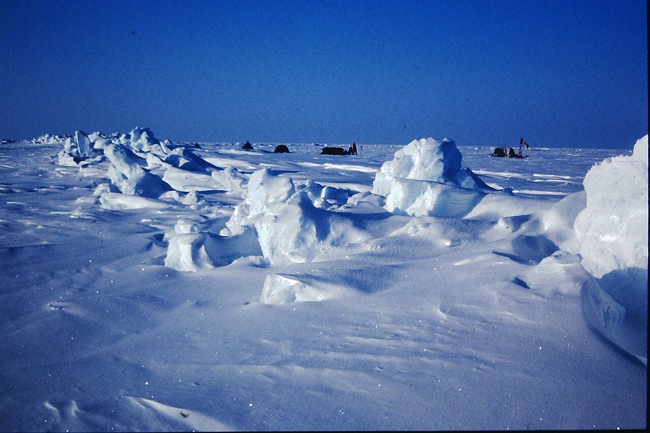
The North Pole is the point in the Northern Hemisphere where the Earth's axis of rotation meets its surface. It is the northernmost point on Earth, lying antipodally to the South Pole, and defines geodetic latitude 90° North. Unlike the South Pole, which lies on a continental land mass, the North Pole is located in the middle of the Arctic Ocean amid waters almost permanently covered with shifting sea ice.
- type
- Geographic point
- location
- Arctic Ocean
- latitude
- 90° North
Lore & Background
The North Pole is by definition the northernmost point on Earth, where all directions point south and all lines of longitude converge. Its longitude can be defined as any degree value, and no time zone has been assigned.
Reader's Guide
The North Pole has been a focus of exploration since the late 19th century, with numerous attempts to reach it. The North Pole's significance lies in its role as a geographic reference point and a symbol of human exploration, though its shifting sea ice and remote location make permanent habitation impractical. Studies in the 2000s predicted that the North Pole may become seasonally ice-free due to Arctic ice shrinkage.
Did You Know?
- The North Pole is located in the middle of the Arctic Ocean amid waters almost permanently covered with shifting sea ice.
- The sea depth at the North Pole was measured at 4,261 m by the Russian Mir submersible in 2007.
- The first undisputed expedition to reach the North Pole was the airship Norge in 1926, led by Roald Amundsen.
- The nearest permanently inhabited place to the North Pole is Alert on Ellesmere Island, Canada, 817 km away.
Scale, Position, and Boundaries
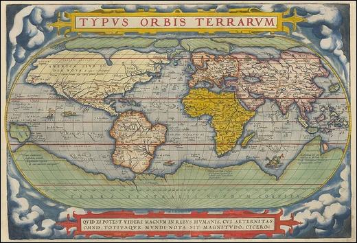
North America stands as the third-largest landmass on Earth, spanning roughly 24.7 million square kilometers and sheltering an estimated 580 million people. As the northern half of the Western Hemisphere's two continental landmasses, it is framed by four major water bodies: the Pacific to the west, the Atlantic to the east, the Caribbean Sea to the south, and the Arctic Ocean to the north. The continent's political geography is layered. Its northern reaches are dominated by Canada, with Greenland occupying the northeastern corner and Alaska—the largest U.S. state—claiming the northwest. The central and southern stretches are shared by the contiguous United States, Mexico, and a constellation of smaller Central American and Caribbean nations. Where exactly the continent ends in the southeast remains a matter of geographic debate: most scholars draw the line at the Darién watershed along the Colombia-Panama border, keeping all of Panama within North America, while a minority prefer the man-made Panama Canal as the dividing point. Greenland, the world's largest island, and numerous Caribbean archipelagos are generally counted among North America's associated islands.
A Craton Written in Deep Time
Beneath the surface of North America lies one of Earth's most ancient geological foundations. Seventy percent of the continent rests on the Laurentia craton, a slab of continental crust whose origins stretch back roughly four billion years. Six microcontinents collided approximately two billion years ago to forge this core, which was later expanded between 1.8 and 1.65 billion years ago when a landmass now spanning from Arizona to Missouri fused along its southern and western edges. Around 1.1 billion years ago the craton began to rift, producing what is now the Midcontinent Rift System, a fissure running between Kansas and Lake Superior before the process halted, possibly due to the Grenville collision to the east. The craton has otherwise remained remarkably stable, preserving rocks dated between 2.5 and 4 billion years. Among these are specimens from the Nuvvuagittuq greenstone belt on Hudson Bay's coast, dated at 4.38 billion years—potentially the oldest known rock on the planet, though the dating methods remain contested. In most supercontinent models, Laurentia served as the nucleus of Rodinia and later formed part of Laurussia, Pangea, and Laurasia.
Five Landscapes, One Continent
North America's physical geography can be parsed into at least five major physiographic regions, each with a distinct character and age. The Canadian Shield, a geologically stable expanse of rock between 2.5 and 4 billion years old, blankets most of the northeastern quadrant including Greenland. To the east, the Appalachian Mountains form an ancient, heavily eroded system that first assembled around 1.3 billion years ago and stretches from Newfoundland down to Alabama. The Atlantic Coastal Plain is a lowland belt that broadens as it moves south, running from south New England all the way to Mexico. The Interior Lowlands thread down the continent's center from the Mackenzie Valley to the Atlantic Coastal Plain, encompassing the Great Plains on the western side and the agriculturally fertile Interior Plains on the eastern side. Finally, the North American Cordillera is a complex mountain-and-plateau belt extending from Alaska into Mexico, some of whose features formed as recently as 65 to 100 million years ago during the Cretaceous. It contains two orogenic belts—the Pacific Margin on the west and the Rocky Mountains on the east—separated by a system of basins and plateaus.
Ice, Water, and the Arrival of Humans
The Quaternary glaciation, beginning roughly 2.58 million years ago, sculpted much of North America's modern landscape. Ice sheets centered west of Hudson Bay depressed the land beneath their immense weight, and the floor is still rebounding today. Glaciers cascaded down the slopes of both the Rocky Mountains and the Pacific Margin, and meltwater pooled into vast temporary lakes—Missoula, Bonneville, Lahontan, Agassiz, and Algonquin—whose remnants persist as the Great Salt Lake, the Great Lakes, and the large lakes of west-central Canada. The same glacial cycles lowered global sea levels, exposing the Bering Land Bridge between Alaska and Siberia and enabling human migration from Asia into the Americas sometime between 40,000 and 15,000 years ago. Earlier still, around three million years ago, the volcanic Isthmus of Panama rose between the two American continents, closing the Central American Seaway and triggering the Great American Interchange, a massive two-way migration of plants and animals. The continent's climate today still reflects its vast latitudinal span, swinging from Arctic cold in the north to tropical heat in the south, with prairies across the central and western interior and deserts dotting the Southwest and northern Mexico.
Gallery


Frequently Asked Questions
What is the North Pole?
It is the exact spot in the Northern Hemisphere where Earth's rotational axis intersects the surface, marking the absolute northernmost coordinate on the planet at 90° North latitude. It sits directly opposite the South Pole as its antipodal counterpart.
Where is the North Pole located?
Rather than resting on solid ground, it sits in the open waters of the Arctic Ocean, surrounded by a constantly shifting blanket of sea ice. This sets it apart from the South Pole, which is anchored to the Antarctic continent.
How deep is the ocean floor beneath the North Pole?
The seabed under the pole lies roughly 4,087 to 4,261 metres below the waterline, placing it in a deep-ocean basin rather than a shallow continental shelf.
What is the closest piece of land to the North Pole?
Kaffeklubben Island, a small outcrop off the coast of Greenland, is the nearest landmass at approximately 700 kilometres away.
Who was the first verified team to reach the North Pole?
In 1926, Roald Amundsen led the crew of the airship Norge to the pole, marking the first confirmed human arrival at that geographic point.
More in Physical Geography & Elevation 25-30
Related in Physical Geography & Elevation
Links follow this subject's own source article.
Elsewhere in the Physical Geography & Elevation universe
Spotted an error? Know more?
This is a living reference — every entry is fact-audited, and reader corrections feed straight into our audit queue. Suggest an edit · See this site's audit record